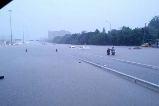
 Environment Canada has predicted that the intense thunderstorms, which have already resulted in flooding and power outages all over Toronto city on Monday, are likely to surpass 100 mm of total rainfall before they ease off later this evening. Meteorologists at Environment Canada are keeping an eye on some slow moving cluster of thunderstorms that have caused localized flash floods. So far, the amount of rainfall today has beaten the previous one-day rainfall record of 29.2 mm in 2008 and also surpassed the almost 70 mm monthly average for July.
The thunderstorms have encompassed the Mississauga and Brampton regions as they move along eastward toward Markham, Richmond Hill and Toronto. Toronto Hydro has mentioned in a statement that almost 300,000 people are deprived of power around the city. It has confirmed that additional crew is also assessing the damage, while sources say almost 80 per cent of Mississauga that has a population of more than 700,000 remains without power too. Powerstream has declared that almost 29,000 of its subscribers in Markham and Richmond Hill are still without power after a loss of supply from Hydro One’s transformer station in Buttonville.
In addition to that, power outage and severe flooding also caused suspension of TTC service at Downsview to St. Clair West, St. Andrew to Bloor, Lawrence to Finch, Jane to Kipling, and the Sheppard Line. Consequently, TTC has halted its entire operation due to signal and power issues throughout the city. Parts of Union Station have been sandbagged in order to stem the flow of water.

Be the first to comment